Drone mapping has become an increasingly popular technology in various industries such as construction, agriculture, and real estate. However, not everyone has the expertise and equipment necessary to conduct drone mapping themselves. That’s where drone mapping companies come in. These companies provide professional drone mapping services for clients who require high-quality aerial images and data for their projects. In this blog post, we will explore some factors to consider when choosing a drone mapping service provider.
1. Experience and Expertise
The first factor to consider when choosing a drone mapping company is their experience and expertise in the field. Look for companies that have experience working in your industry or similar industries. Check their portfolio to see examples of their previous work and make sure they have a track record of producing high-quality results. Additionally, look for companies that have certified and trained pilots who are familiar with the latest drone technology.
2. Equipment and Technology
The quality of the drone mapping services you receive will depend on the quality of the equipment and technology used. Choose a company that uses state-of-the-art equipment and software to ensure high-quality aerial images and data. Also ensure they use survey grade equipment with GNSS RTK or PPK technologies for ground control.
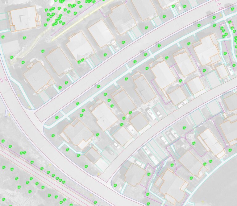
3. Data Processing Capabilities
Drone mapping is not just about collecting aerial images and data, but also processing and analyzing that data. A good drone mapping company should have the capability to process and analyze the data collected to produce accurate and detailed reports. They should also have the capacity to provide different types of output such as 2D and 3D maps, orthomosaic maps, point clouds, and other types of data analysis.
4. Safety and Compliance
Safety is crucial when it comes to drone mapping. Look for companies that have redundancy built into their equipment, a strong safety record and adhere to safety protocols during the mapping process. Additionally, the company should comply with regulations set by the Federal Aviation Administration (FAA) and any other local regulations related to drone mapping.
5. Cost and Timeline
Finally, consider the cost and timeline of the drone mapping services. Look for a company that offers competitive pricing and can provide a clear timeline for the project. Make sure you understand the scope of work, any additional fees or charges, and the expected delivery date for the final deliverables.
Conclusion
Choosing a drone mapping company requires careful consideration of several factors, including their experience and expertise, equipment and technology, data processing capabilities, safety and compliance, and cost and timeline. By selecting a reputable drone mapping company with a proven track record, you can ensure that you receive high-quality aerial images and data that will benefit your project.