Drone mapping is becoming an increasingly popular tool, and one that increasingly helps businesses save time and money in construction projects. The technology allows construction professionals to collect high-quality aerial data, which is used to improve project planning, reduce risks, and improve project delivery. In fact, in a 2022 survey, 53% of survey respondents reporting that capturing a digital twin was important to their business. In this blog post, we will explore some of the key benefits of drone mapping for construction professionals.
Benefit 1. Improved Project Planning
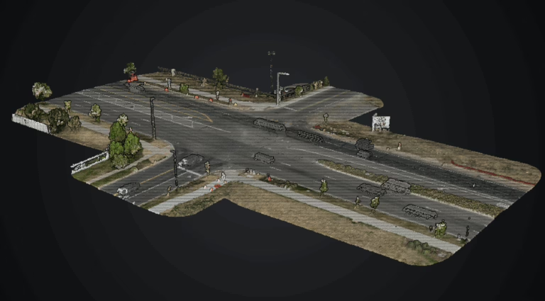
Drone mapping provides construction professionals with detailed aerial images and data of the construction site, which can be used to improve project planning. With this data, construction professionals can create detailed 2D and 3D models of the construction site, allowing them to identify potential issues and plan for solutions before construction begins. This saves time and money by avoiding potential delays and change orders during construction.
Benefit 2. Accurate Site Analysis
Drone mapping provides construction professionals with a more accurate site analysis compared to traditional surveying methods. Drones capture high-quality aerial images and data, which is used to create accurate topographic maps and 3D models of the construction site. This information identifies potential challenges such as uneven terrain, difficult access, and drainage issues.
Benefit 3. Improved Communication and Collaboration
Drone mapping improves communication and collaboration between construction professionals, project managers, and clients. The detailed aerial images and data provide stakeholders with a better understanding of the construction site and the project scope. This leads to more effective communication, better collaboration, and improved decision-making.
Benefit 4. Increased Safety and Risk Mitigation
Drones collect data from hard-to-reach areas of the construction site, which can reduce safety risks for construction professionals. This technology can also be used to identify potential safety hazards such as unstable terrain, hazardous materials, and unsafe work conditions. This information can be used to mitigate safety risks and prevent accidents. Drone data could even be used to support job site insurance claims.
Benefit 5. Improved Project Delivery
By using drone mapping, construction professionals improve project delivery times and reduce costs. The technology allows for faster data collection and processing, which reduces the time required for site analysis and project planning. This helps construction professionals deliver projects on time and on budget.
Conclusion
Drone mapping is a valuable tool that provides construction professionals with detailed aerial images and data that improves project planning, reduces risks, and improves project delivery. The technology enables more accurate site analysis, improved communication and collaboration, increased safety, and faster data processing. By using drone mapping, construction professionals optimize their construction projects and deliver better results for their clients. As a result, drone mapping leads to saving time and money.