

“Cool LiDAR” or “Defensible Survey Deliverables?”
A lot of LiDAR products look good. Pretty point clouds. Smooth surfaces. Clean contours. Nice...
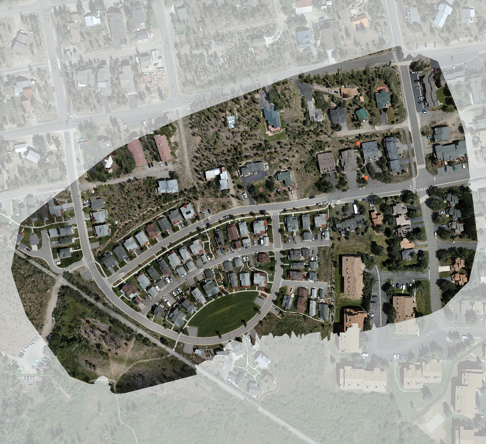
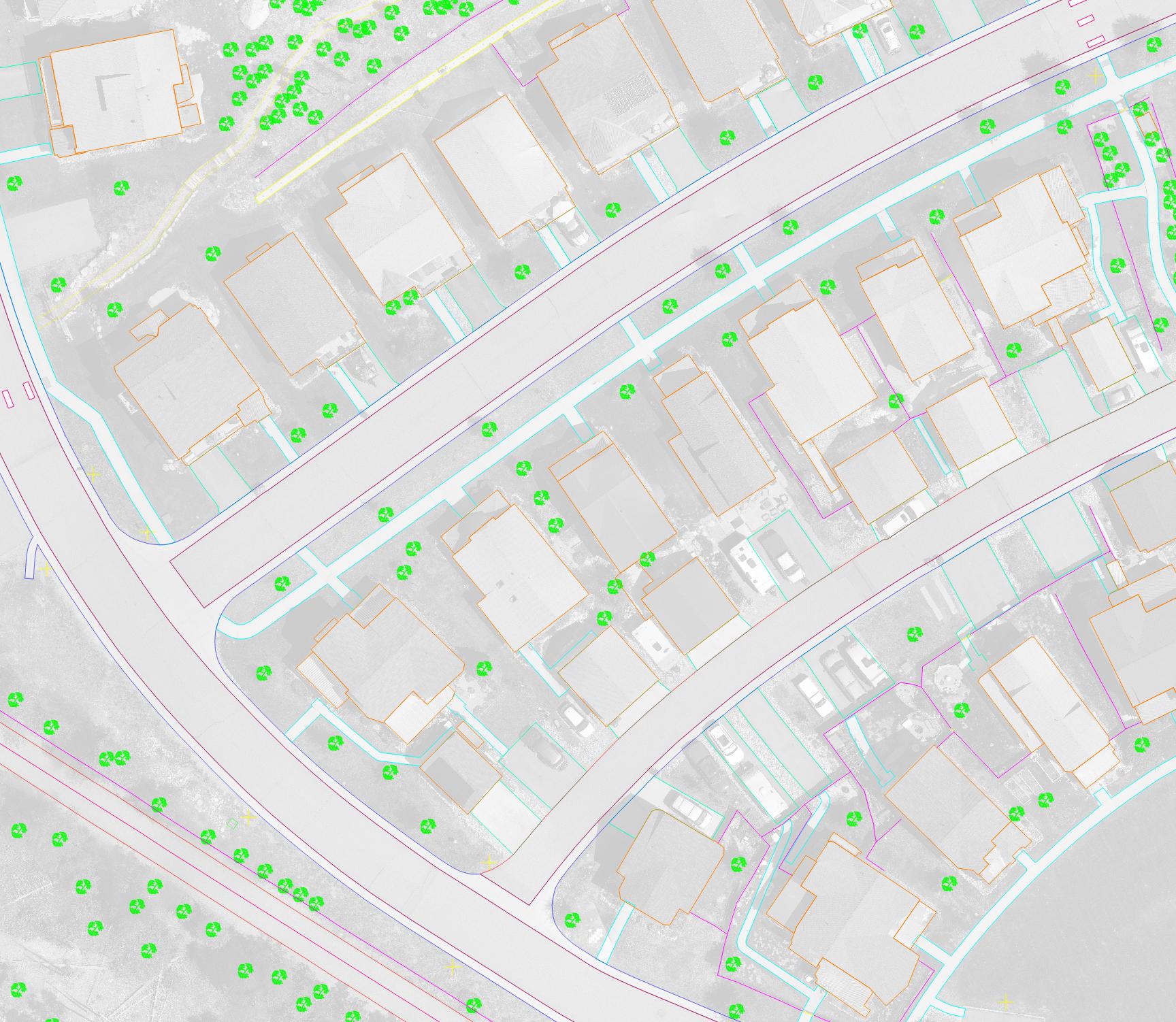
High-Resolution Aerial Visualization — Now Simplified for Urban and Community Projects
Urban mapping just became a lot more accessible. With FAA Category operations now approved, TopoMatters...

Navigating Military Airspace and Class D Authorization Roadblocks
How TopoMatters Can Help You Get Your Project Off the Ground In recent discussions with...

Enhancing TopoMatters’ Workflow with AI for Smarter, More Efficient LiDAR Processing
At TopoMatters, we’re always refining our workflow to deliver the most precise and efficient survey-grade...

TopoMatters® is now an Autodesk Authorized Developer
Exciting news for the future of TopoPro® LiDAR Processing deliverables. TopoMatters new ability to access...

Enhancing LiDAR Workflows with 7-Parameter Transformations: Is the industry making progress?
At the recent Geo Week event held in Denver Colorado, I had the opportunity to...

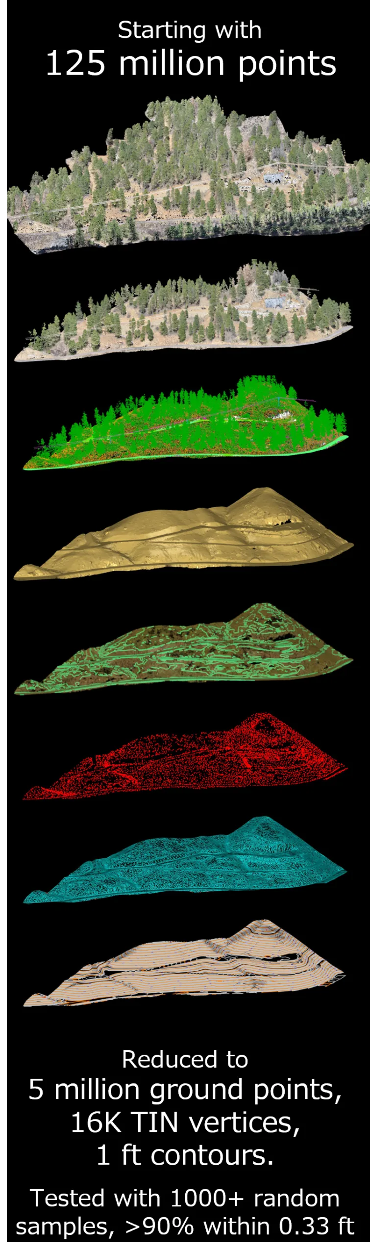
Conquer Point Cloud Bloat and Deliver Superior LiDAR Survey Results with TopoPro®
Consulting Services Now Open for Limited Pilot Projects! TopoMatters® internal workflow and software, TopoPro®, post-processes...

TopoMatters® Expands Trademark Portfolio to Meet Growing Demand for High-Fidelity Survey Data and Aerial Insights
Buena Vista and Frisco, Colorado (November 12, 2024) — TopoMatters®, a regional leader in aerial...
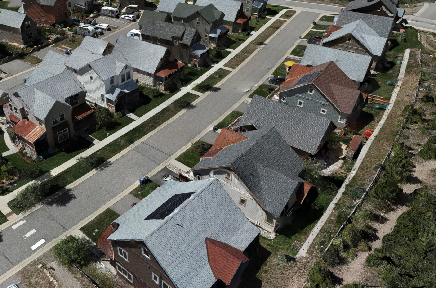
Colorado drone survey data – why you must avoid generic service providers
In the world of professional land surveying, particularly across the varied terrains of Colorado, accuracy...
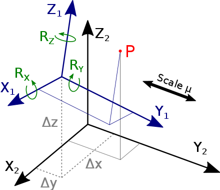
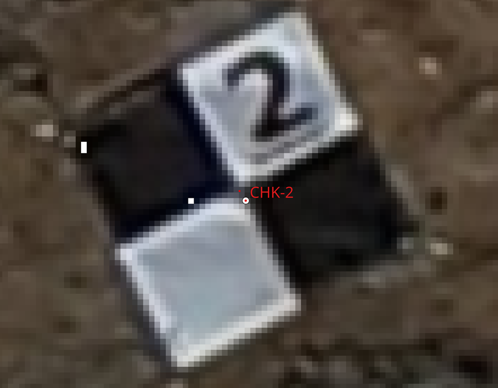
7-Parameter Helmert Transformations: Ensuring Accuracy in Land Survey Deliverables
In land surveying, producing precise and accurate deliverables is paramount. 3-dimensional transformations play a vital...
Mapping Horizons: Elevating GIS with Drone Photogrammetry and Coordinate Systems Integration
Introduction: In the dynamic realm of Geographic Information Systems (GIS), the quest for precision and...
TOPOMATTERS JOINS MWUAS CORPORATE SPONSORS
Buena Vista, Colorado (March 6, 2024) — Mountain West UAS (MWUAS) is proud to announce...
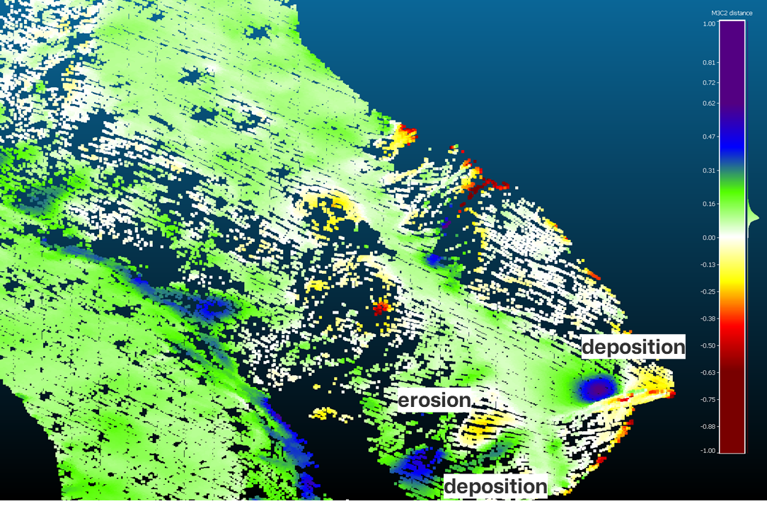
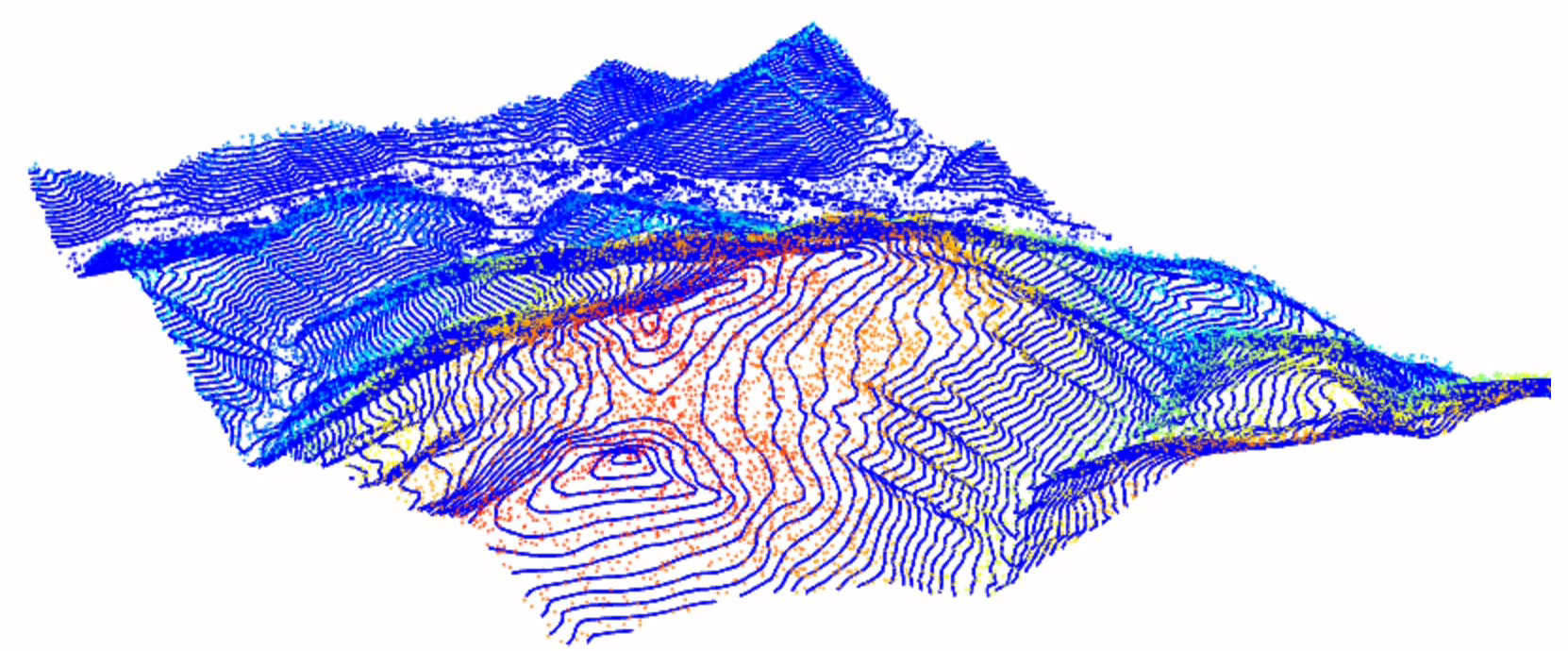
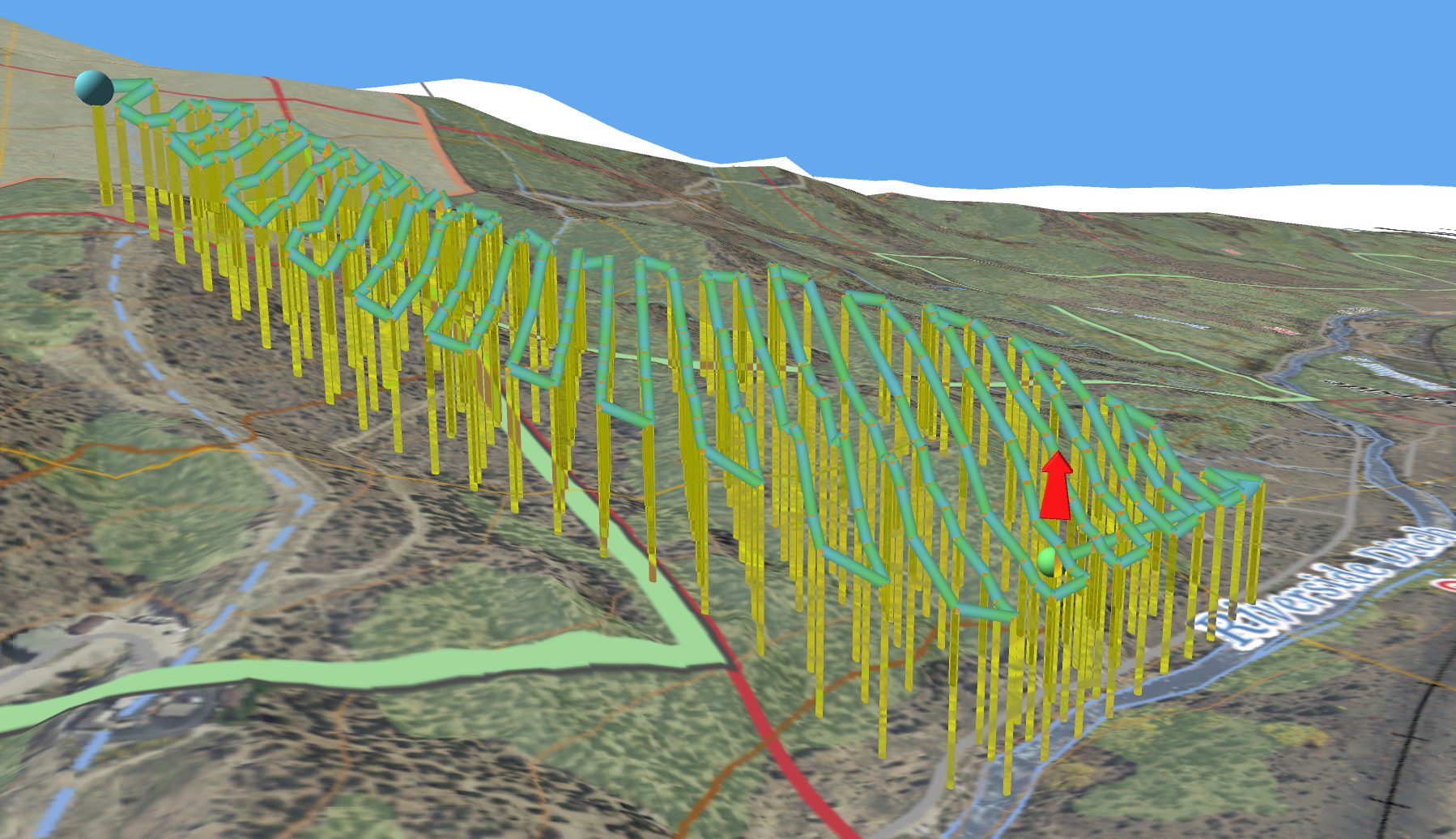
Harnessing Drone LiDAR for Assessing Slope Erosion and Stability: A Comprehensive Approach
Introduction: Slope erosion poses a significant threat to landscapes, infrastructure, and communities worldwide. Understanding slope...
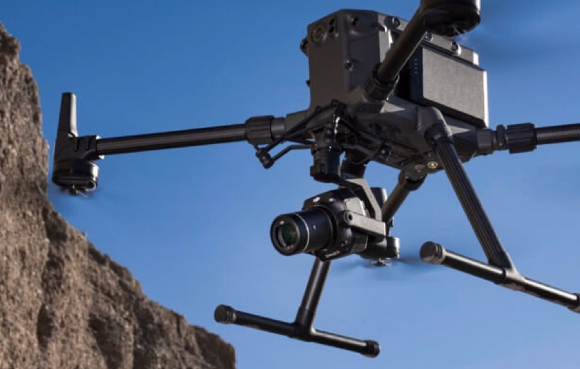
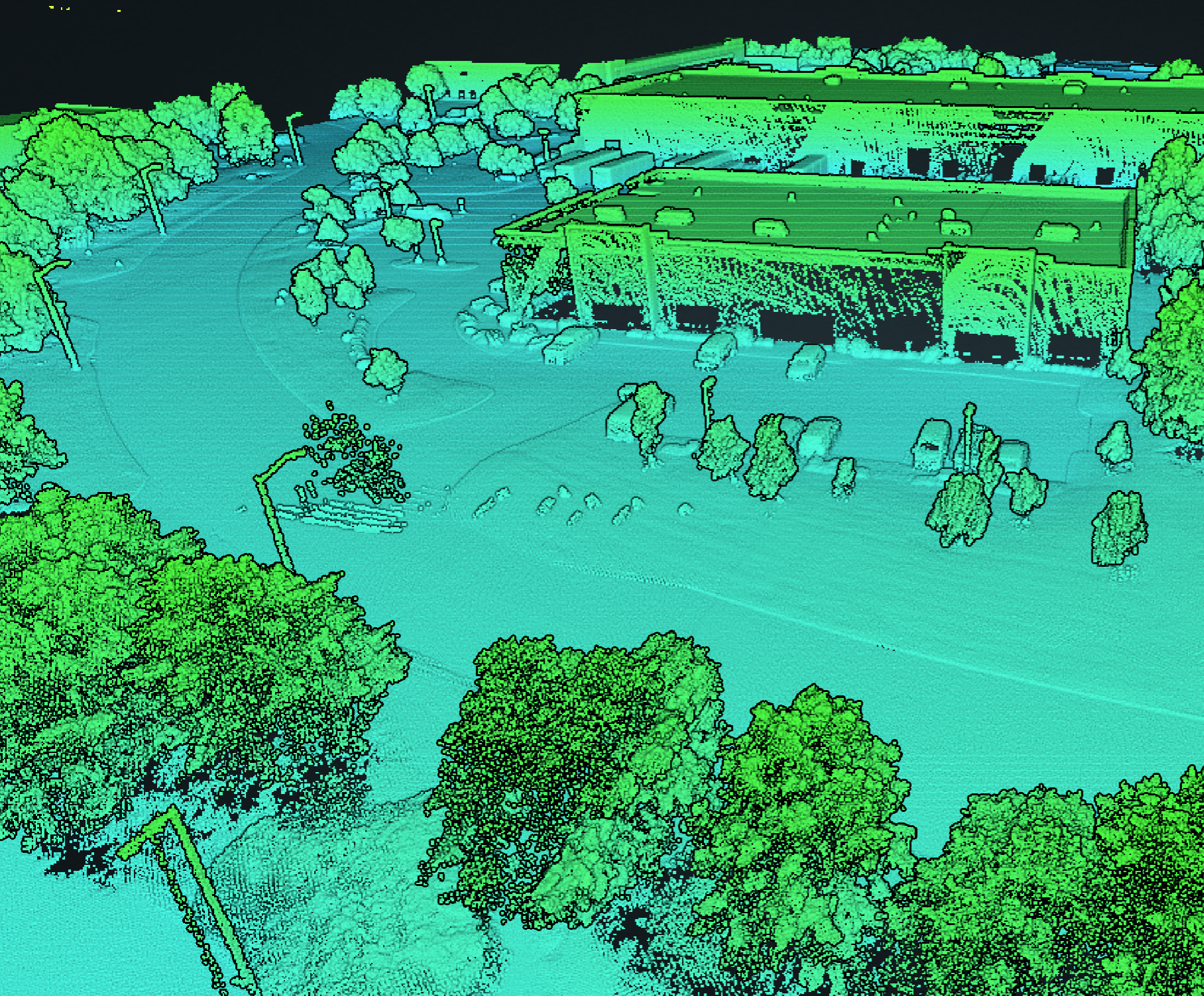
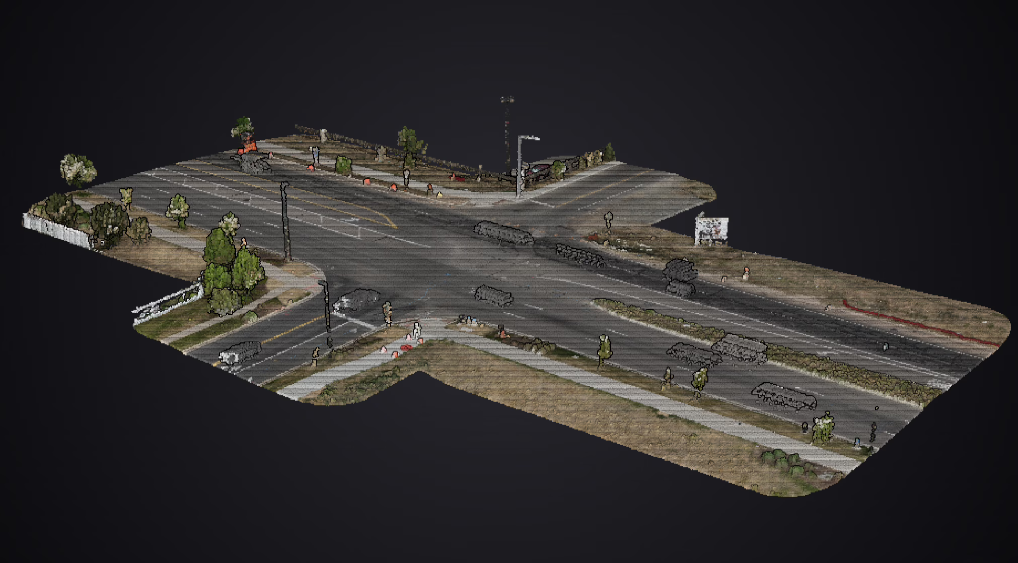
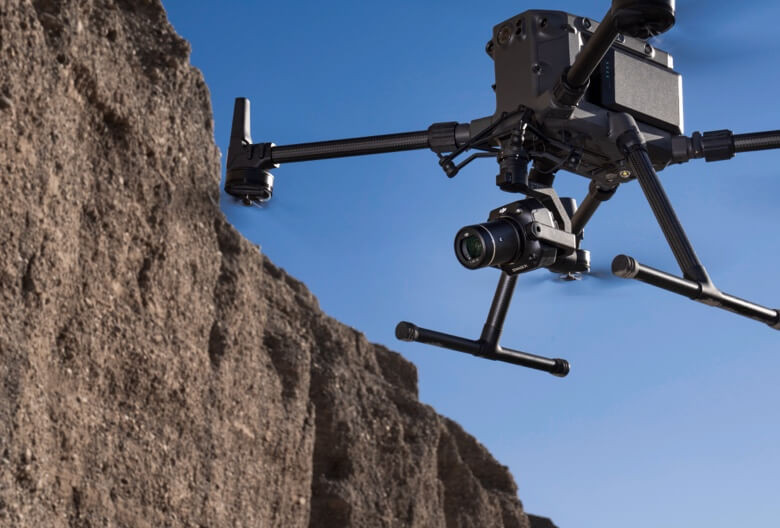
Real World Testing DJI P1 and L2 Sensors with ASPRS Edition 2 Positional Accuracy Standards
Welcome to an in-depth exploration of precision drone mapping, where we delve into the practical...
Considerations for choosing a drone mapping provider (2024 Update)
Drone mapping has become an increasingly popular technology in various industries such as construction, agriculture...
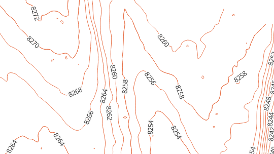
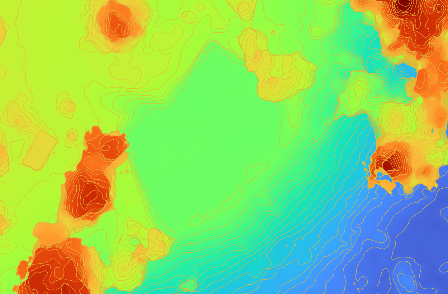
What are LiDAR maps? Understanding cartographic vs. engineering contours
Contours are those curved lines that trace out areas of equal elevation on a map...
Demystifying Drone Mapping Technology: Navigating Photogrammetry and LiDAR Deliverables
In the ever-evolving landscape of technical mapping, the integration of cutting-edge technologies has opened up...
Aerial insights: elevate profits with drone mapping for aggregate businesses
Introduction In the dynamic world of aggregate sales, staying at the forefront of technology can...
Soaring High: Unveiling the benefits of drone mapping for earthworks companies
Introduction In the ever-evolving realm of construction and earthworks, staying ahead of the curve is...
Understanding 2 critical drone survey company service options
Photogrammetry or LiDAR? Upon searching for a drone survey company, many people quickly become overwhelmed...
Why LiDAR? Learn the pros and cons of aerial LiDAR data for surveying
Surveying is the process of measuring and mapping the physical features of the Earth, such...
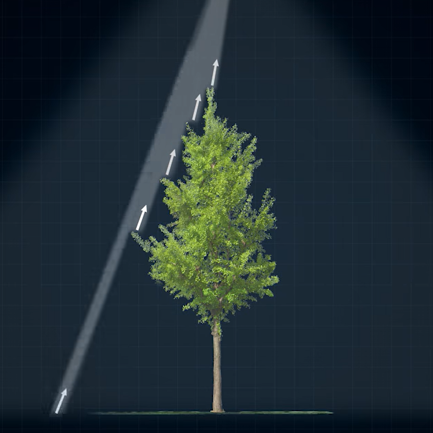
Top 3 advantages of 5 return LiDAR
LiDAR is a technology that uses laser pulses to measure the distance and shape of...
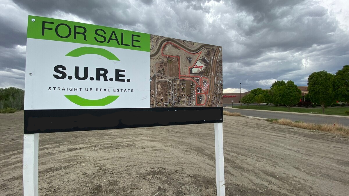
5 top ways to market land with drone mapping
In this blog post, we will explore how drone data can help market land and...
Quality UAS data in variable terrain
When it comes to collecting accurate data through remote sensing technologies, terrain awareness and ground...
Photogrammetry versus LiDAR, which is better?
Photogrammetry vs LiDAR. Both are popular methods for creating 3D models. Both methods have their...
Improve commercial property assessments
Commercial assessors are professionals who are responsible for assessing the value of commercial properties such...
Considerations for choosing a drone mapping provider
Drone mapping has become an increasingly popular technology in various industries such as construction, agriculture...

Architects, accelerate time to revenue with drone data
How often are your client projects stalled due to analysis paralysis? Drone mapping has become...
Save time and money in construction
Drone mapping is becoming an increasingly popular tool, and one that increasingly helps businesses save...
Survey technology in drone mapping
Drone mapping has become an essential tool for professionals in industries such as construction, agriculture...
Better community planning with drones
Community planners are responsible for designing and managing the physical and social infrastructure of cities...

GSD is a critical factor in drone mapping
Drones, also known as unmanned aerial vehicles (UAVs), have revolutionized the way we collect data...
5 reasons you should not buy a drone for your business
Drones have become increasingly popular over the past few years and have revolutionized the way...