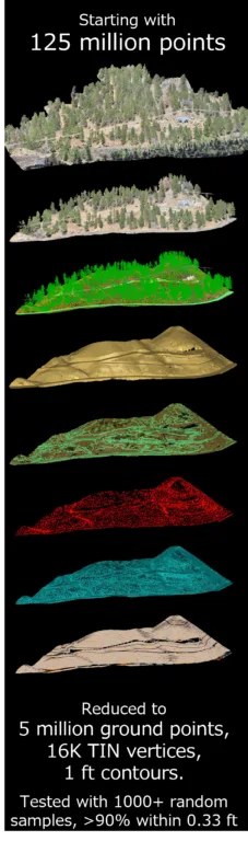
A lot of LiDAR products look good.
Pretty point clouds. Smooth surfaces. Clean contours. Nice hillshade screenshots.
It is pretty easy to create a DTM model and raster-derived contours from nearly any drone workflow.
But as licensed surveyors, you know that looking good and holding up are two very different things.
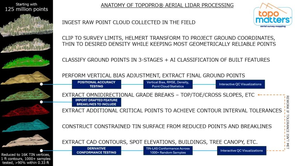
The graphic below shows what happens between raw LiDAR collection and survey‑ready deliverables in a TopoMatters TopoPro® workflow. Not the flashy part—but the part that actually matters when accuracy, tolerance, and your professional responsibility are on the line.
It starts with discipline:
- clipping strictly to survey limits
- transforming directly into project ground coordinates
- thinning to a usable density without sacrificing geometric reliability
Then comes judgment:
- multi‑stage ground classification
- AI‑assisted extraction of built features, followed by validation
- vertical bias assessment and correction before accepting anything as “final ground”
Only after that do we start treating the terrain as terrain:
- omnidirectional grade break extraction
- top / toe / cross‑slope logic
- supplemental critical points added specifically to meet contour interval tolerances
From there, a constrained TIN can actually mean something.
And finally, we prove it.
- Testing of independent check shots.
- Vertical accuracy statistics.
- Massive random sampling of the surface, with percent‑within‑tolerance reporting that makes it clear where it performs well—and where it may need to be tightened up depending on the project tolerances (edges, irregular terrain, vegetation).
Because a surface isn’t defensible because it’s smooth or pretty.
It’s defensible because the error is understood, measured, and documented.
That’s the difference between “cool LiDAR” and defensible surveying.