
Power your planning simulations with drone mapping and 3D LiDAR
Stand out from the competition with a digital storytelling canvas! While a site survey remains a standard tool in the site planning process, the site plan and vicinity map often do not tell the full story of the project location’s existing conditions.
Communicate your vision with drone data
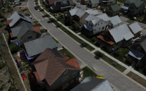
3D models serve as a digital canvas for planning simulations, providing immersive context and texture to communicate your vision, while also having the flexibility to be rotated to the perspective views that best tell your story.
Refresh your base maps with existing conditions
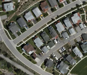
Base maps are crucial for community planners as they provide a foundational understanding of an area’s physical features and characteristics. Inaccurate base maps can lead to inaccurate assessments, flawed planning recommendations and community disengagement.
Integrate with your existing systems
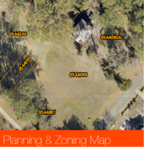
TopoMatters data is always geo-referenced so you can pull it directly into existing software platforms owned by you and your clients. ArcGIS, QGIS, Revit and more. Providing this data to your client creates value by enhancing clients’ existing GIS records and enabling additional geospatial analysis.

Expand your business with value added services
GIS and CAD linework go beyond base maps by adding layers of insightful data for informed decision-making. Imagine interactive story maps that empower communities to plan for growth and mitigate challenges. Unleash the potential of maps, transforming data into powerful tools for shaping a better future.
Planners, designers, communities and clients all benefit when you integrate 2D and 3D site reference documentation and visualization into your planning simulation project workflow. Whether you need geo-referenced orthophotos, CAD linework, a textured 3D model or something in between, we’ve got you covered.