
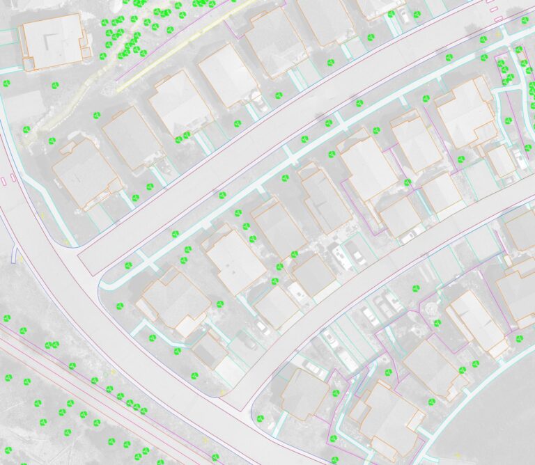
Introduction: In the dynamic realm of Geographic Information Systems (GIS), the quest for precision and efficiency in capturing existing conditions has spurred...
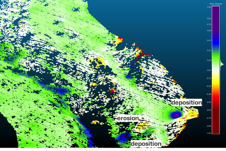
Introduction: Slope erosion poses a significant threat to landscapes, infrastructure, and communities worldwide. Understanding slope stability is crucial for...
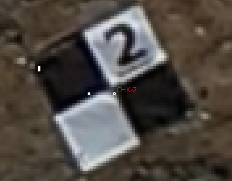
Welcome to an in-depth exploration of precision drone mapping, where we delve into the practical application of Edition 2 of the American Society for...
Drone mapping has become an increasingly popular technology in various industries such as construction, agriculture, and real estate. However, not everyone has...
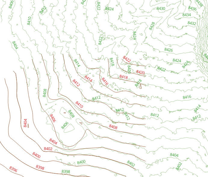
Contours are those curved lines that trace out areas of equal elevation on a map. They’re like the topographic fingerprints of the land, revealing its ups...
In the ever-evolving landscape of technical mapping, the integration of cutting-edge technologies has opened up new realms of possibilities. One such enchanting...