Introduction: Slope erosion poses a significant threat to landscapes, infrastructure, and communities worldwide. Understanding slope stability is crucial for mitigating risks and ensuring safety. Traditional methods of slope evaluation often involve time-consuming processes. However, advancements in technology, particularly the use of drone LiDAR (Light Detection and Ranging), are revolutionizing how we assess slope erosion and stability.
In this blog post, we delve into the innovative applications of drone LiDAR technology for evaluating slope erosion and stability, highlighting its benefits and real-world implications, including measuring change with point cloud normals in addition to using a DTM raster.
Understanding Drone LiDAR: LiDAR technology uses laser pulses to measure distances and generate precise 3D models of the Earth’s surface. When mounted on drones, LiDAR systems can capture high-resolution data with remarkable accuracy and efficiency. This aerial perspective enables comprehensive coverage of terrain, including inaccessible or hazardous areas, making it ideal for slope analysis.
Assessing Slope Erosion: One of the primary applications of drone LiDAR is in mapping and monitoring slope erosion. By conducting regular surveys, LiDAR-equipped drones can provide detailed insights into the extent and rate of erosion over time. This data is invaluable for land managers, environmental scientists, and engineers tasked with erosion control and restoration efforts.
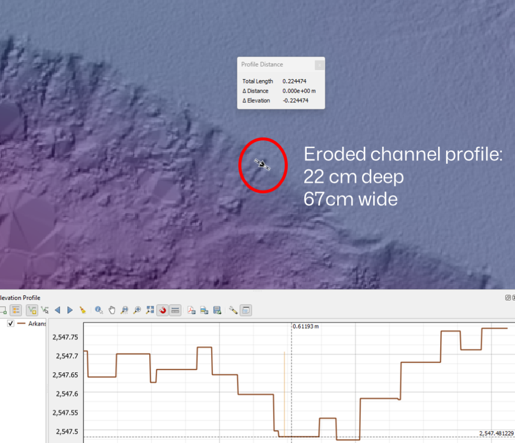
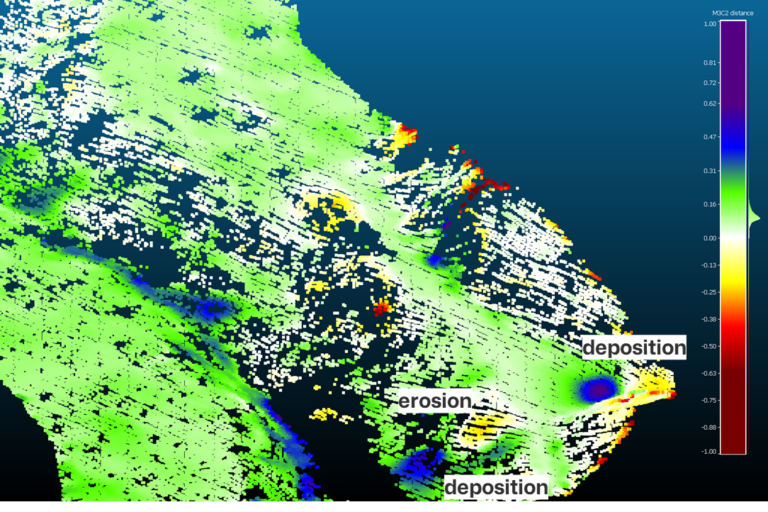
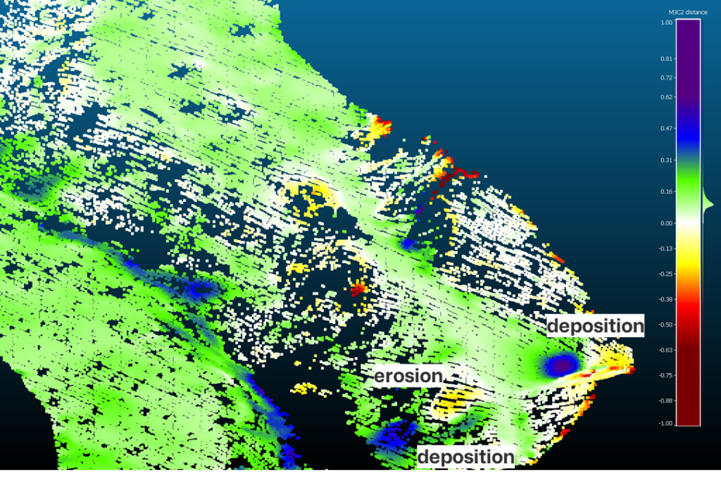
Drone LiDAR can detect subtle changes in terrain elevation, enabling the identification of erosion hotspots and vulnerable areas. By comparing successive LiDAR scans, analysts can quantify erosion rates and predict future erosion trends. This proactive approach facilitates timely interventions to prevent further degradation and preserve the stability of slopes.
Evaluating Slope Stability: In addition to erosion assessment, drone LiDAR plays a crucial role in evaluating slope stability. By generating high-resolution topographic maps, LiDAR data provides detailed information about slope morphology, including gradient, aspect, and surface roughness. These parameters are essential for assessing the stability of slopes and identifying potential failure mechanisms.
Moreover, drone LiDAR data can be processed to derive point cloud normals, which represent the orientation of surface points relative to their neighbors. By analyzing changes in point cloud normals over time, researchers can detect subtle deformations and anticipate slope instability before visible signs appear. This nuanced approach complements traditional methods and enhances our understanding of slope dynamics.
Real-World Applications: The application of drone LiDAR for slope erosion and stability evaluation extends to diverse environments and industries. From assessing landslide risk in mountainous regions to monitoring coastal erosion along shorelines, LiDAR-equipped drones offer a versatile solution for terrain analysis.
In the construction and infrastructure sectors, drone LiDAR is increasingly utilized for site planning and monitoring. By assessing slope stability before and during construction projects, stakeholders can mitigate risks, optimize design decisions, and ensure the safety and longevity of built structures.
Conclusion: Drone LiDAR technology represents a game-changer in the field of slope erosion and stability evaluation. Its ability to capture high-resolution data rapidly and non-invasively revolutionizes how we assess and manage slope-related risks. By harnessing the power of drone LiDAR and integrating point cloud normals analysis, we can make informed data-driven decisions, implement proactive measures, and safeguard our landscapes and infrastructure for generations to come.